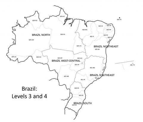
The following maps show the level 3 and level 4 regions for the World Geographic Scheme for Recording Plant Distributions. Level 3 units are outlined in grey and the units are labeled with a standardized 3 letter code for level 3 designations. Most units are not divided further, but if they are then there are multiple codes within one unit, each code with a different two letter suffix. That suffix indicates the lowest (level 4) designation.
For instance, The countries Norway, Sweden and Finland are level-3 designations, but those countries are not further sub-divided, so their labels show just their three-letter code (NOR, SWE, FIN respectively). However, Ireland is broken into two level four sub-units, Ireland and Northern Ireland. Therefore, within the Ireland sub-unit, there are two labels with the level 3 and level four designations (IRE-IR and IRE-NI respectively). Maps for all global regions are shown on this page, click on the picture for a larger version.
 The Ries Lab of Butterfly Informatics


